![](/images/other/stat-length.png)
![Tour Wandern La Bastide - La Bastide-Palomere-StMarsal - Photo](https://media.geolcdn.com/t/1900/400/066ff25d-18cd-428d-a0f2-6b6204b49f6e.jpg&format=pjpeg&maxdim=2)
La Bastide-Palomere-StMarsal
ThonyM
Benutzer
![Länge](/images/other/stat-length.png)
Länge
19,8 km
![Maximale Höhe](https://static1.geolcdn.com/siteimages/upload/files/1508320355ic_sort_altitude_max_24dp.png)
Maximale Höhe
1213 m
![Positive Höhendifferenz](https://static1.geolcdn.com/siteimages/upload/files/1508320355ic_sort_den_pos_24dp.png)
Positive Höhendifferenz
821 m
![Km-Effort](/images/other/stat-length.png)
Km-Effort
31 km
![Min. Höhe](https://static1.geolcdn.com/siteimages/upload/files/1508320355ic_sort_altitude_min_24dp.png)
Min. Höhe
622 m
![Negative Höhendifferenz](https://static1.geolcdn.com/siteimages/upload/files/1508320355ic_sort_den_neg_24dp.png)
Negative Höhendifferenz
820 m
![Boucle](https://static1.geolcdn.com/siteimages/upload/files/16400158638029165_repeat_loop_refresh_sync_direction_icon.png)
Boucle
Ja
Erstellungsdatum :
2019-10-24 06:38:56.0
Letzte Änderung :
2019-10-24 13:34:50.222
![Wandern](https://static1.geolcdn.com/sitytour/trail-icons/101.png)
6h51
Schwierigkeit : Sehr schwierig
![Scannen Sie diesen QR-Code, um die Tour in der SityTrail-Anwendung zu öffnen](https://capi.geolives.com/qq0zvz2zws4bq2lad0pu/sitytour/trails/2248572/qr.png?size=200)
Kostenlosegpshiking-Anwendung
Über SityTrail
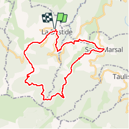
Tour Wandern von 19,8 km verfügbar auf Okzitanien, Ostpyrenäen, La Bastide. Diese Tour wird von ThonyM vorgeschlagen.
Beschreibung
A part quelques passages délicats au niveau des cours d’eau, de belles descentes et montées sur les 5 derniers Kim’s, une tres belle randonnée
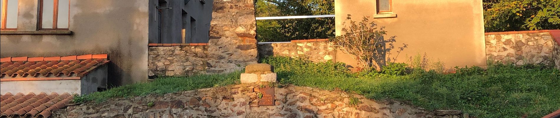
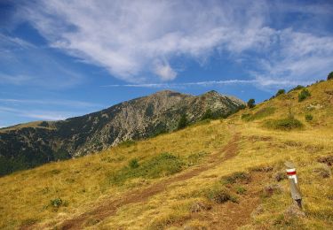
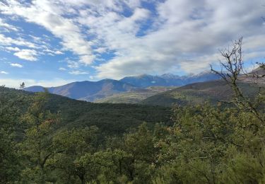
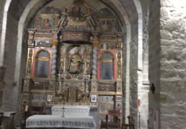
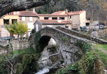
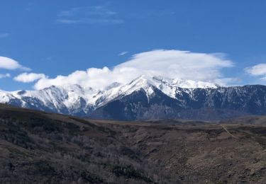
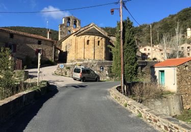
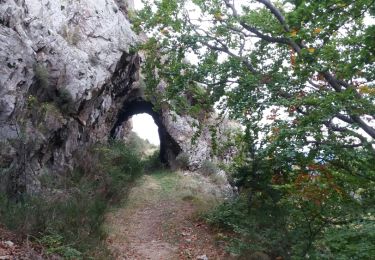
Ort
Land:
France
Region :
Okzitanien
Abteilung/Provinz :
Ostpyrenäen
Kommune :
La Bastide
Standort:
Unknown
Gehen Sie:(Dec)
Gehen Sie:(UTM)
466077 ; 4710685 (31T) N.
Kommentare
Touren in der Umgebung
![Tour Zu Fuß Valmanya - Tour del Canigó - Photo](https://media.geolcdn.com/t/375/260/d70f77f9-d4e3-4a97-8f21-2b252e3f9842.jpeg&format=jpg&maxdim=2)
![Zu Fuß Zu Fuß](https://static1.geolcdn.com/sitytour/trail-icons/100.png)
Tour del Canigó
Zu Fuß
Sehr schwierig
Valmanya,
Okzitanien,
Ostpyrenäen,
France
![](/images/other/stat-length.png)
63 km | 113 km-effort
25h 42min
![](https://static1.geolcdn.com/siteimages/upload/files/16400158638029165_repeat_loop_refresh_sync_direction_icon.png)
Ja
![Tour Wandern Prunet-et-Belpuig - BOULE d'AMONT - La TRINITE - Photo](https://media.geolcdn.com/t/375/260/63148342-eaf9-42f9-af5b-21ab9e845710.jpg&format=jpg&maxdim=2)
![Wandern Wandern](https://static1.geolcdn.com/sitytour/trail-icons/101.png)
BOULE d'AMONT - La TRINITE
Wandern
Medium
Prunet-et-Belpuig,
Okzitanien,
Ostpyrenäen,
France
![](/images/other/stat-length.png)
12,4 km | 17 km-effort
3h 20min
![](https://static1.geolcdn.com/siteimages/upload/files/16400158638029165_repeat_loop_refresh_sync_direction_icon.png)
Ja
![Tour Wandern Prunet-et-Belpuig - Boule d’amont /Chapelle de la Trinité / Prunet - Photo](https://media.geolcdn.com/t/375/260/68eed7a9-ae13-40d7-8c91-a7b1707b93bf.jpg&format=jpg&maxdim=2)
![Wandern Wandern](https://static1.geolcdn.com/sitytour/trail-icons/101.png)
Boule d’amont /Chapelle de la Trinité / Prunet
Wandern
Einfach
Prunet-et-Belpuig,
Okzitanien,
Ostpyrenäen,
France
![](/images/other/stat-length.png)
11,2 km | 16 km-effort
3h 6min
![](https://static1.geolcdn.com/siteimages/upload/files/16400158638029165_repeat_loop_refresh_sync_direction_icon.png)
Ja
![Tour Wandern Baillestavy - 20221127 Baillestavy- Valmanya - - Prat Mitja - Photo](https://media.geolcdn.com/t/375/260/72e21f75-cd75-4254-89f0-c0a060a5d8d3.jpg&format=jpg&maxdim=2)
![Wandern Wandern](https://static1.geolcdn.com/sitytour/trail-icons/101.png)
20221127 Baillestavy- Valmanya - - Prat Mitja
Wandern
Schwierig
Baillestavy,
Okzitanien,
Ostpyrenäen,
France
![](/images/other/stat-length.png)
16,8 km | 30 km-effort
5h 2min
![](https://static1.geolcdn.com/siteimages/upload/files/16400158638029165_repeat_loop_refresh_sync_direction_icon.png)
Ja
![Tour Wandern Baillestavy - 20220519 Ballestavy - Photo](https://media.geolcdn.com/t/375/260/4d0efe9c-9bcb-43a8-b0f2-554388676ee1.jpg&format=jpg&maxdim=2)
![Wandern Wandern](https://static1.geolcdn.com/sitytour/trail-icons/101.png)
20220519 Ballestavy
Wandern
Medium
Baillestavy,
Okzitanien,
Ostpyrenäen,
France
![](/images/other/stat-length.png)
12,6 km | 21 km-effort
3h 28min
![](https://static1.geolcdn.com/siteimages/upload/files/16400158638029165_repeat_loop_refresh_sync_direction_icon.png)
Ja
![Tour Wandern Boule-d'Amont - 20210321 Boule d’Amont - Serrabone - Photo](https://media.geolcdn.com/t/375/260/16b44598-e6b8-4fe8-87e4-5112a1cd140b.jpg&format=jpg&maxdim=2)
![Wandern Wandern](https://static1.geolcdn.com/sitytour/trail-icons/101.png)
20210321 Boule d’Amont - Serrabone
Wandern
Medium
Boule-d'Amont,
Okzitanien,
Ostpyrenäen,
France
![](/images/other/stat-length.png)
13,4 km | 23 km-effort
3h 58min
![](https://static1.geolcdn.com/siteimages/upload/files/16400158638029165_repeat_loop_refresh_sync_direction_icon.png)
Ja
![Tour Wandern Prunet-et-Belpuig - Boule d’amont Prunet-et-Belpuig la Trinité - Photo](https://media.geolcdn.com/t/375/260/a989c071-b899-4092-a76b-68c708add189.jpg&format=jpg&maxdim=2)
![Wandern Wandern](https://static1.geolcdn.com/sitytour/trail-icons/101.png)
Boule d’amont Prunet-et-Belpuig la Trinité
Wandern
Schwierig
Prunet-et-Belpuig,
Okzitanien,
Ostpyrenäen,
France
![](/images/other/stat-length.png)
13,7 km | 19,4 km-effort
3h 25min
![](https://static1.geolcdn.com/siteimages/upload/files/16400158638029165_repeat_loop_refresh_sync_direction_icon.png)
Ja
![Tour Wandern La Bastide - col de palomere . tour de batere . retour via le chemin de fer - Photo](https://media.geolcdn.com/t/375/260/ext.jpg?maxdim=2&url=https%3A%2F%2Fservices.sitytrail.com%2FGeolivesWS%2FDownloadMedia.ashx%3FTrailID%3D1063763%26Media%3Dfix__20181029162316.jpg)
![Wandern Wandern](https://static1.geolcdn.com/sitytour/trail-icons/101.png)
col de palomere . tour de batere . retour via le chemin de fer
Wandern
Einfach
La Bastide,
Okzitanien,
Ostpyrenäen,
France
![](/images/other/stat-length.png)
10,9 km | 17,6 km-effort
3h 10min
![](https://static1.geolcdn.com/siteimages/upload/files/16400158638029165_repeat_loop_refresh_sync_direction_icon.png)
Ja
![Tour Wandern Baillestavy - Baillestavy la Lenrilla - Photo](https://media.geolcdn.com/t/375/260/ext.jpg?maxdim=2&url=https%3A%2F%2Fservices.sitytrail.com%2FGeolivesWS%2FDownloadMedia.ashx%3FTrailID%3D1029641%26Media%3Dfix__20180821154614.jpg)
![Wandern Wandern](https://static1.geolcdn.com/sitytour/trail-icons/101.png)
Baillestavy la Lenrilla
Wandern
Medium
Baillestavy,
Okzitanien,
Ostpyrenäen,
France
![](/images/other/stat-length.png)
14,4 km | 25 km-effort
6h 2min
![](https://static1.geolcdn.com/siteimages/upload/files/16400158638029165_repeat_loop_refresh_sync_direction_icon.png)
Ja